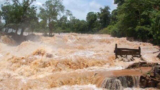

Cyclonic storm Arnab and heavy rain have affected 10,545 people from 2,736 families in 12 districts, with one person dead, according to the Disaster Management Centre (DMC).
The DMC said in its situation report issued at 6PM on 26 October that 57 Divisional Secretariat divisions are affected. A person drowned in Madampe in the Puttalam District, and another was injured in Ingiriya in the Kalutara District when a tree fell on a house.
Four safety centres in Colombo, Ratnapura and Mannar are sheltering 182 people from 67 families, while 60 others are staying with relatives. Two houses have been fully destroyed and 215 partly damaged.
Sri Lanka Railways has suspended Main Line services between Gampola and Nanu Oya, so trains are running only between Nanu Oya and Badulla. Trains between Peradeniya and Matale have been halted. In Kalutara, the Bulathsinhala–Molkawa and Galathara–Pareigama roads are under up to 2.5 feet of water.
The Department of Irrigation has issued amber flood warnings for low-lying areas along the Attanagalu Oya and the Kelani River, valid until 6PM on 27 October. The Attanagalu Oya warning covers nine divisions: Divulapitiya, Mirigama, Attanagalla, Mahara, Gampaha, Minuwangoda, Ja-Ela, Katana and Wattala. Water levels there have risen further after spill gates at the Basnagoda Reservoir were opened.
The Kelani warning covers Ruwanwella, Seethawaka, Dompe, Dehiowita, Eheliyagoda, Yatiyantota and Bulathkohupitiya. Officials said flooding could extend downstream beyond Hanwella if heavy rain continues.
The Natural Hazards Early Warning Centre said the storm lay near latitude 15.4 North and longitude 88.9 East at 5.30AM on 26 October. It is expected to move west-northwestwards and intensify into a severe cyclonic storm over the west-central Bay of Bengal. The Department of Meteorology expects rain above 75 mm in several areas.
Background
The National Building Research Organisation (NBRO) and the Department of Meteorology recorded more than 100 mm of rain at 16 locations in Ratnapura, Kalutara, Nuwara Eliya and Kegalle in the 24 hours to 6PM on Monday. The highest total was 185.4 mm at Samanalagama in the Pelmadulla division of Ratnapura, followed by 170.4 mm at Gavaragiriya and 170.2 mm at Pahiyangala in Bulathsinhala.
Reservoir gates have been opened to release water, including 18 gates at Rajanganaya, eight at Deduru Oya, four at Tabowa, and two each at Angamuwa and Kala Wewa. Two gates at Kukule Ganga are discharging 148 cubic metres per second. The Norton, Canyon, Laxapana and Polpitiya dams are also spilling.
The NBRO has placed high-risk divisions in Ratnapura, Kalutara, Kandy, Kegalle, Nuwara Eliya and Kurunegala under Level 2 amber and Level 3 red landslide warnings, which call for residents to be ready to evacuate. The tri-forces, police, Coast Guard and Civil Security Department have deployed rescue boats and search teams, and Air Force helicopters are on standby.
What it means
All government schools will be closed on Tuesday, 27 October, and the National Secretariat for Early Childhood Development has said all preschools and early childhood development centres will also be closed that day.
Residents of the flood-prone and landslide-prone areas named above are being urged to follow instructions from local disaster response officers. Travellers to the hill country should expect disruption to train services, and motorists in parts of Kalutara should expect flooded roads.